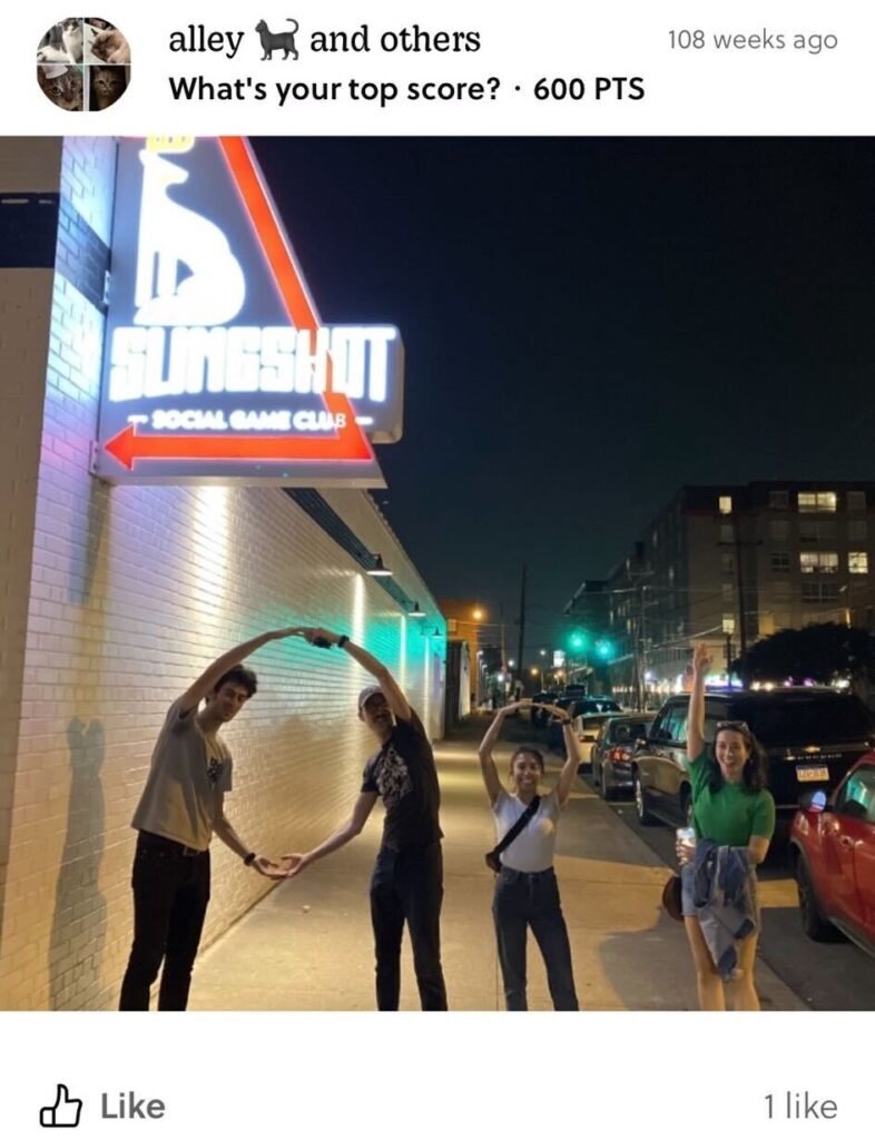
During a scavenger hunt, two years ago, I knew State of the Map US — the annual conference for the OpenStreetMap (OSM) community — was my favorite conference. My scavenger group was called Alley Cats. The OpenStreetMap US team crafts these scavenger hunts with locals in every city SOTM US takes part in. It was a hot summer evening in Richmond, and we walked, speed-walked, and ran to different spots as the sun was setting. In that group, I met Ariel and Harrison — fellow New Yorkers and active OSMers — whom I’ve loved seeing year after year at SOTM US; I now get to serve on the board with Harrison.
Conversations ping-ponged as we moved through the city. I learned how Ariel and Harrison met, and chatted with Zhi Keng, my friend and coworker at the time, and Charles, a doctoral student in Germany with a background in urban planning and geoinformatics. Somehow, we ended up deep in conversation about Mayor Bill de Blasio’s 2018 plan to improve diversity at New York City’s specialized high schools — expanding the Discovery Program and phasing out the SHSAT as the sole admissions criterion. We discussed how some Asian American parent groups were against the bill, worrying that their kids who had historically gained access to these elite schools through the SHSAT would lose access to an opportunity they had long relied on. One person was strongly in support of the bill, while another chimed in with empathy for the parents, acknowledging how, after spending so much money and energy on test prep, it could feel like all that effort was being thrown away.
I am not new to the pressure of using individual education as a socioeconomic ladder up, as an Asian American or an American in general, but my stance is that our liberation is bound together. If my liberation comes at the expense of yours, it is not liberation. It was a powerful conversation on racism among marginalized groups, and how some communities — including my own — can be positioned as a wedge against Black and Brown students’ access to education. It was a real conversation: open, respectful, and willing to peel back the layers of what shapes our communities. These are the kinds of magical moments that make State of the Map US my favorite conference.
For the three years I’ve gone, I’ve seen more diverse voices represented. The openness, the willingness to listen, to go deep, to think collectively — those traits have stayed true across everyone I’ve met. State of the Map US has these sweet, easy-to-miss, kind of interpersonal moments. And they always stand out to me. We’re doing so much more than just mapping.
Tracing the Lines Between Us
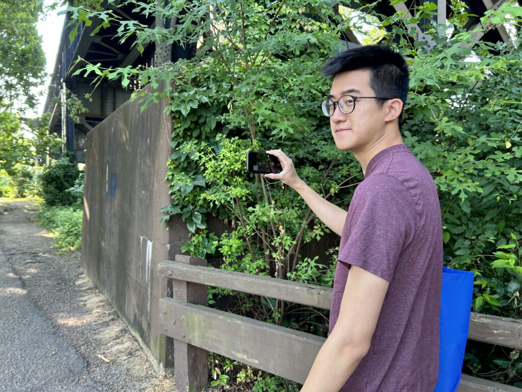
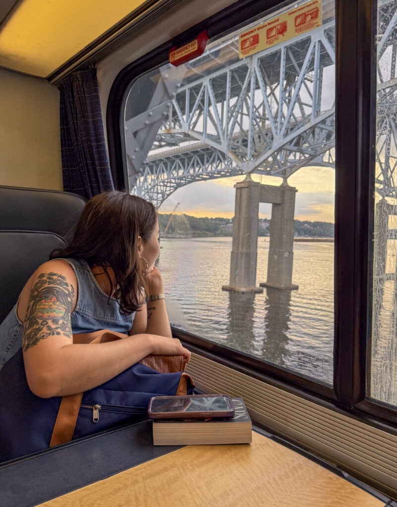
The BetaNYC team caught a 5 AM train from New York—delirious, undercaffeinated, and excited for the magic of State of the Map US. We came to represent BetaNYC’s Mapping for Equity, a community project that helps people map what’s missing in their neighborhoods and use that data for advocacy. It puts public data back in public hands–something people can shape and build power with. Dimitri and I started at BetaNYC at around the same time and have grown the Mapping for Equity Project from the ground up. Naeema joined soon after as one of our first fellows to learn OSM and now serves as an integral part of teaching our students and capturing Mapillary footage as well.
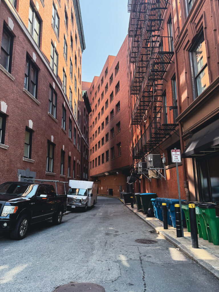
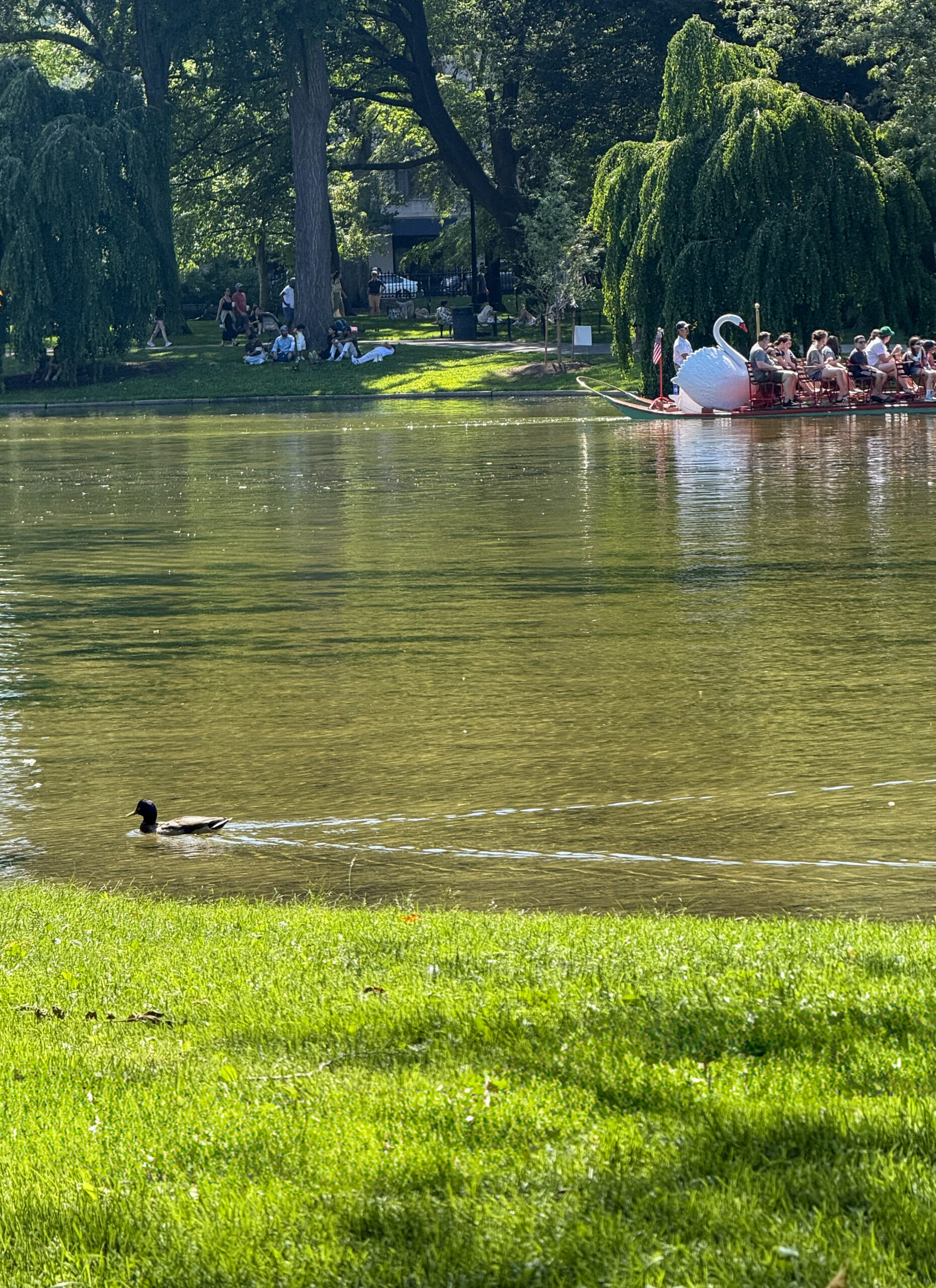
Part of the SOTM US magic is getting to know a new place with thoughtfulness, as mappers do. You can research a city, but you don’t understand it until you’re there with its residents. Boston was green, curated. At the city’s heart sits Boston Common, the nation’s first public park. Ducks abound, trees’ arms resting overhead as people spread across the grass on blankets. Next to it, the swan boats swim through the pond. I hadn’t realized how much of a college town it was—much smaller than New York, but with urban familiarities that felt comfortingly familiar to us New Yorkers. My team and I enjoyed watching museum-goers throw boxes of “tea” into the harbor at the Boston Tea Party Ships & Museum—taking “the past is always present” to a literal level.
There’s also the anticipation of whom you’ll see: familiar faces, new ones, and folks you barely knew last year but now share pizza with.
The People Behind the Maps
At the heart of SOTM US are the people. What always sticks with me are the stories and the minutia of their day-to-days: what brought them here, what they care about, how mapping shows up in their lives, how their lives show up in the map. I always leave touched by what folks choose to share — their art, their struggles, their neighborhoods.
I met Clifford Snow, known for his large contributions in the Pacific Northwest. He’s also a glass-blowing artist — his OSM username is Glassman. I attended his talk on Safe Routes to School, where he discussed how OSM can be used to map key pedestrian infrastructure around schools: speed limits, traffic calming, crosswalks, and more. Clifford’s talk was a reminder that good mapping reflects the needs of local communities. Something as simple as walking to school — often treated as just another challenge — can become something we care for and improve through mapping.
I didn’t get to see Tim Feller’s talk in person, but I heard it was phenomenal — and from my interactions with him, he is a thoughtful and hilarious person. His presentation, Mapping for Neurodiversity: A Call to Innovate, invited the OSM community to consider how mapping can better serve people who are neurodiverse. He introduced neurodiversity as an umbrella term that embraces a wide range of cognitive differences — including autism, ADHD, dyslexia, Tourette’s, and more — and challenged us to consider how we describe features, choose datasets, and collaborate. His talk explored sensory-friendly mapping, inclusive cartography, and game-based learning, and from what I heard, folks left inspired and thinking differently about what inclusive mapping can look like.
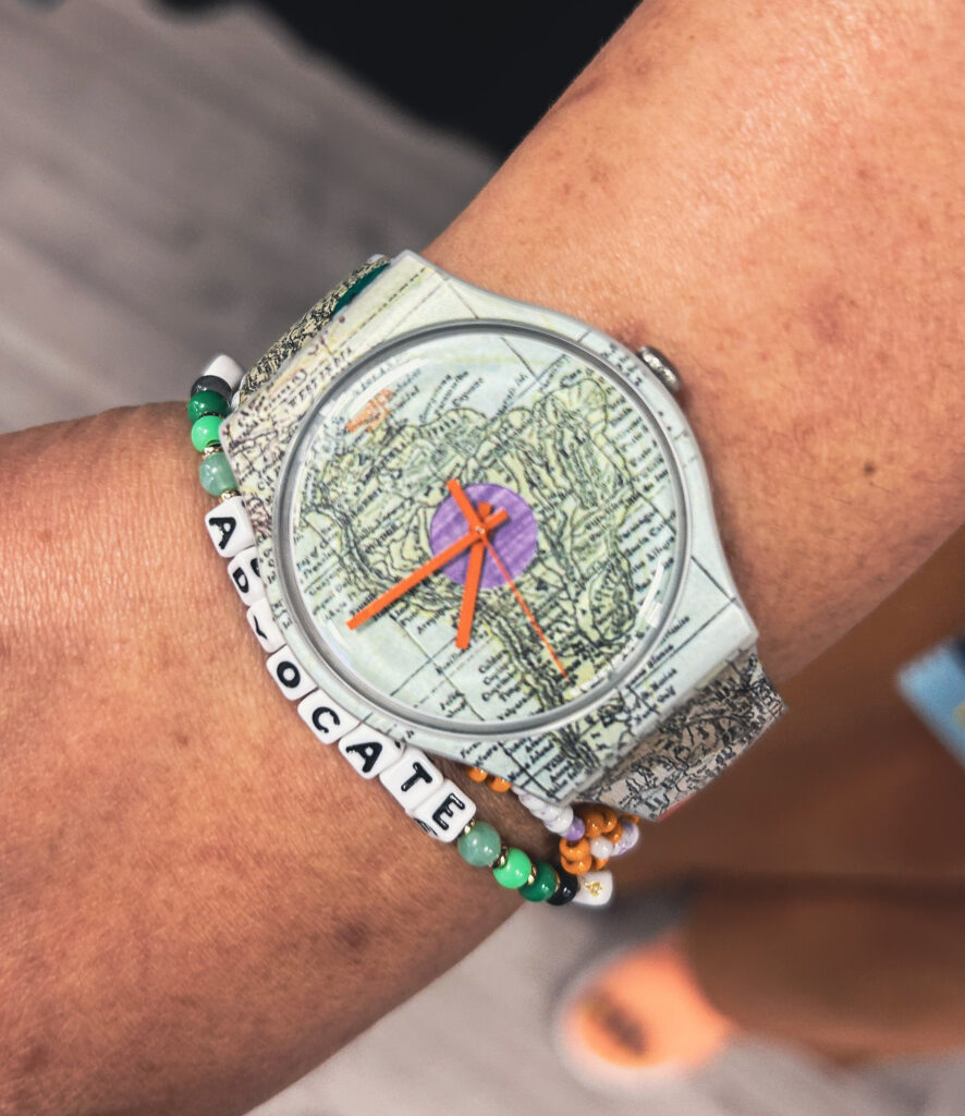

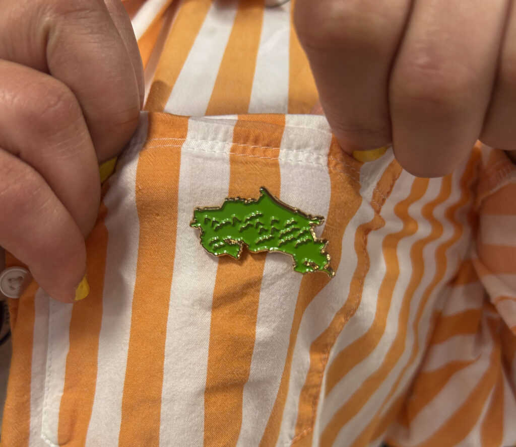
I met Silvia Rivera Alfaro, another incredible New Yorker, a SOTM US conference scholar, and a member of the Geochicas collective. We raved about how her look was effortlessly on theme — she showed me her analog watch with a map throughout the face and the wristband, a Costa Rica state pin on her chest, and a palette of browns and oranges, all in linen, that felt both refreshing and powerful, much like her presence. Her talk, The Other Streets: Adding NYC Honorary Street Names, focused on visualizing community identity through honorary naming practices. Centering on Washington Heights and Inwood, Silvia brought a feminist lens to questions like: What’s in a name? Whose stories do our streets tell? And why should these honorary names be added to OSM? Her presentation made the case for how visualization can deepen community understanding and memory.
I also attended a wonderful session by Celeste Reynolds and her students, titled Practice-Based Lessons Using OSM to Develop New Mapper Skills in the Classroom. The session shared a project-based learning model for introducing OSM to students — and not just teaching them how to map, but helping them understand why mapping matters. It was inspiring to see students take the lead, creating and shaping their own understanding of open data and community geography. They’re not just learning the tools; they’re the future of this work.
Community Doesn’t Build Itself
Why doesn’t everyone get on OpenStreetMap? Not all of OSM is warm, friendly, or easy to navigate — and that’s exactly what Gopinath Gnanakumar Malathi explored in his poster presentation, Designing for Belonging in OpenStreetMap. His research examined the barriers people face when participating in OSM, especially through platforms like the OSM Community Forum. He examined how patterns of communication can subtly shape who feels welcome and who doesn’t. Even when responses are well-meaning or neutral on the surface, they can reinforce unspoken norms and discourage new voices from participating.
His work asks: What kinds of behaviors and interaction styles invite people in — and which ones push them out? And how can the OSM ecosystem be intentionally designed to foster a greater sense of belonging?
These are the kinds of questions I think about all the time. Why aren’t more of our neighbors on here? Why does mapping sometimes feel like a niche club, instead of a public tool anyone can use? As an OSM US board member, one of my core goals is to help make OSM a space that feels accessible, welcoming, and truly reflective of the people who live in the places we map.
And while we’re thinking about who’s shaping this space, I want to acknowledge how much effort it takes to make something like State of the Map US actually happen. It’s not for the faint of heart. It’s powered by a small but mighty team: Maggie Cawley, Nellie Blair, Alyssa Castronuovo, and Jake Low, along with the incredible volunteers who step up every year to make it all run. This is labor that requires sleepless nights, care, coordination, and resources. As a community, we urgently need continued — and expanded — funding to support not just events like this, but the full ecosystem that keeps OSM US growing and thriving.
Join OpenStreetMap—We Need You!
Especially if you come from a marginalized background I invite you to create a free account, read through the sources on the OSM Wiki or learn from a fellow community member how to add edits, and join OpenStreetMap, because your perspective is urgently needed. Your lived experience, your sense of place, and your questions belong here.
Mapping together is an act of sharing power. Open data is civic infrastructure, and like any shared system, it needs stewards who reflect the fullness of our communities. Mapping isn’t just technical. It’s political, cultural, and deeply personal. It’s a way we collectively decide what’s visible, what’s valuable, and what gets left out.
Data has not always been used in service of liberation. It’s been and is being used to surveil, to exclude, to erase. Many communities have experienced data not as empowerment, but as harm. That history lives in the backdrop of this work, and it’s why reclaiming the tools of mapping, on our terms, matters so much.
What we choose to map is ultimately a record of what we believe matters. Imagine if our public institutions taught de-escalation and collaboration — how to find common ground — instead of competition and extraction. Maybe that feels like a pipe dream in a country so deeply rooted in capital and control, but I believe in doing what we can, now, together. OpenStreetMap and gatherings like SOTM US conference offer us a tool and a community — to practice just that.

Here’s How to Join Us
If you’re wondering where to begin, here are a few ways to get involved:
- Become a member of OSM US. Your membership helps sustain this community — it’s one of the most direct ways to support the continuation of OpenStreetMap as a democratic, people-powered space.
- Don’t just stay behind the screen. Meet your local mappers — people grounded in place, practice, and care.
- Join a Mapping for Equity event (if you’re in NY). Help map the missing public infrastructure in NYC communities and learn hands-on.
- Subscribe to BetaNYC’s newsletter. Stay connected to NYC’s civic tech scene — from Mapping for Equity events to public interest tech happenings around the city, plus highlights from our community and partners.
- Hop into your local OSM Slack channel. This is where the relationships and conversations start!
- Join an OSM working group. Whether you’re interested in pedestrian mapping or education, you’ll find folks trying to build a better project from the inside.
- Come to SOTM US next year. Meet the people behind the edits and experience what makes this community so special.
- Subscribe to the OSM US newsletter. It’s the best way to stay in the loop on upcoming events, new tools, community stories, and ways to plug in — delivered straight to your inbox.
There’s a place for you here — and the map is better with you on it.