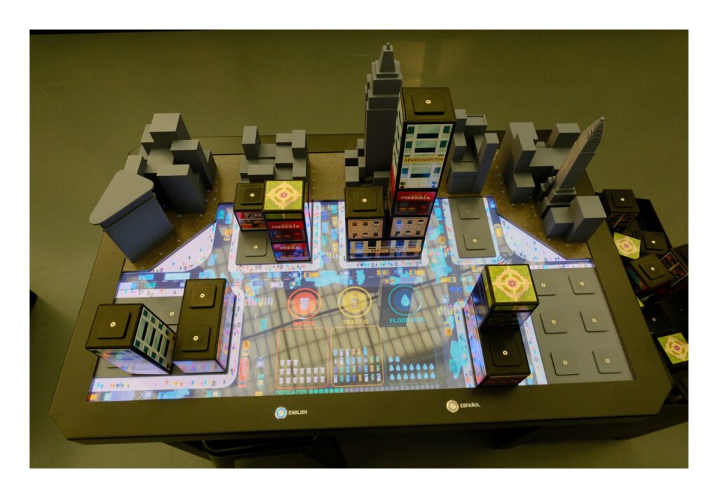
In collaboration with the New York Hall of Science (NYSCI), the Civic Innovation Lab at BetaNYC provided research and data analysis to support the connected city systems simulation exhibit within NYSCI’s new CityWorks exhibition.
The Lab, which typically acts as an interpreter between raw data and end-users to support decision-making or policy, used 18 open datasets from city, state, and federal sources for this project. This involved defining parameters for three archetypal NYC neighborhoods across key city systems like traffic, waste generation, and flood risk, and determining the impact of five different building types on these systems. By placing and stacking building blocks on an interactive playing surface, visitors can explore how these different building types impact their chosen neighborhood, demonstrating the tradeoffs urban planners and policymakers consider.
Collaborating with NYSCI was an exciting opportunity for the Lab to apply its open data expertise in a new way. The primary goal shifted from informing policy or advocacy efforts to fostering learning and curiosity among a middle- and high-school-aged audience. A key aspect of this project was focusing on the faithful relationships between simulation components rather than precise numerical outputs, as the exhibit itself does not display raw numbers to the users. Instead, the Lab developed unitless relationships based on real-world data (sometimes using creative proxies like subway ridership for pedestrian activity), which were then used by partners at Trivium to build the interactive simulation.
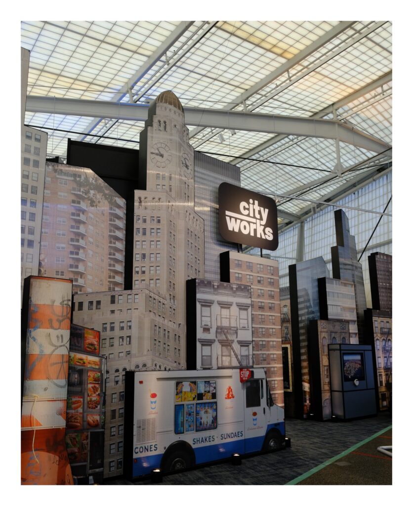
Check out the exhibition to see this innovative approach for engaging a broad public audience with the power of open data!
CityWorks is now part of the permanent exhibit at the New York Hall of Science in Queens.
New York Hall of Science, 47-01 111th St., Corona, NY, 11368
CityWorks at NYC School of Data 2025
News References
- NYSCI Website
- NYSCI Press Release
- NY Times article (Archive.today)
- QNS Paper
- Spectrum News Coverage
Datasets Referenced
- Department of City Planning. Primary Land Use Tax Lot Output (PLUTO). Release 24v3.1., Accessed November 26, 2024.
- Department of Sanitation. DSNY Monthly Tonnage Data. Accessed November 26, 2024.
- Department of City Planning. 2020 Neighborhood Tabulation Areas (NTAs). Accessed September 24, 2024.
- Department of Environmental Protection. NYC Stormwater Flood Maps. Accessed October 2, 2024.
- Federal Emergency Management Agency. Preliminary Flood Insurance Rate Maps (PFIRMs) 2015. Accessed February 9, 2024.
- Office of Technology and Innovation. NYC Planimetric Database: Open Space (Parks). Accessed October 4, 2024.
- New York State Energy Research and Development Authority (NYSERDA). Final Disadvantaged Communities (DAC) 2023. Accessed October 2, 2024.
- United States Census Bureau. P1 | Race. Accessed September 24, 2024.
- Citi Bike. 2023 Citi Bike Trip Data. Accessed September 27, 2024.
- Department of City Planning. LION Single Line Street Base Map. Accessed October 4, 2024.
- Department of Transportation. All Station AADT and Truck Percent Statistics. Accessed September 27, 2024.
- Department of Transportation. New York City Bike Routes. Accessed October 4, 2024.
- Metropolitan Transportation Authority. MTA Subway Hourly Ridership: 2020-2024. Accessed October 3, 2024.
- Metropolitan Transportation Authority. MTA Subway Stations and Complexes. Accessed October 3, 2024.
- Office of Technology and Innovation. NYC Planimetric Database: Sidewalk. Accessed October 4, 2024.
- Office of Technology and Innovation. NYC Street Centerline (CSCL). Accessed October 4, 2024.
- Department of Parks and Recreation. Parks Properties. Accessed October 4, 2024.
- Department of Sanitation. Litter Basket (Map). Accessed October 4, 2024.
- United States Census Bureau. H9 | Total Population in Occupied Housing Units By Tenure. Accessed November 18, 2024.