Skip to content
BetaNYC
  • About
    • Our Mission
    • Our History
    • Our Team
    • Code of Conduct & Anti-harassment Policy
    • Privacy Policy
  • Our Work
    • Workforce Development
    • Civic Innovation Lab
    • Public Programs
      • Open Data Week
      • School of Data
      • Open Data Ambassadors
      • BetaBagels
  • Resources
    • Research and Data Assistance Requests (RADAR)
    • Featured Tools
      • Boundaries Map
      • Urban Heat Portal
      • Floodgen
      • School Budgets Dashboard
      • D33 Tree Stewardship Map
      • Topographic Address Assignment Database
      • NYC Batch Geocoder
      • Scout
    • Publications
    • Testimony
    • Teaching Materials / Classes
    • Mapping For Equity (M4E)
  • Events
  • News
  • Get Involved
    • Join Our Community
    • Upcoming Events
    • Newsletter
    • Events News
Newsletter
Donate

NYC Batch Geocoder

Context

Geocoding is the process of taking an address (1 Centre Street) or geographic context (Municipal Building) and returning geographic coordinates and other information. (40.712974, -74.003676, lot 121)

It has been as mostly inaccessible to non-technical users in NYC as the tools required downloading a application (GeoSupport), knowing how to use APIS or programming languages/ libraries, or one time request on websites (GOAT).

For technical users, [batch] geocoding large amount of address, verifying the quality of them, and correcting for errors is complex workflow. This may require error handling in scripts or correcting then re-running of the software over and over…

In 2019, the DCP’s Planning Labs team created NYC GeoSearch. (GeoClient API is a good alternative, with more advance functions) In addition a tool created by Erik Willems connect to similar API had a simple web tool for journalist to geocode. Inspired BetaNYC created the Batch geocoder for nyc.

Features

Limit queries to a borough or custom boundary
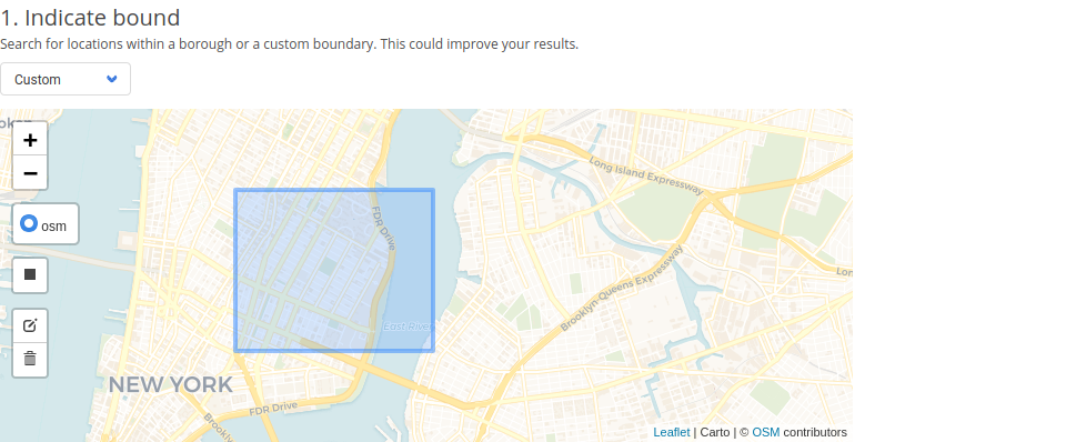
Either select a borough or ‘custom’ in the drop down to select a boundary. If custom is selected click on the rectangle on the left to start drawing your boundary.

Continuously add entries by pasting or uploading a file
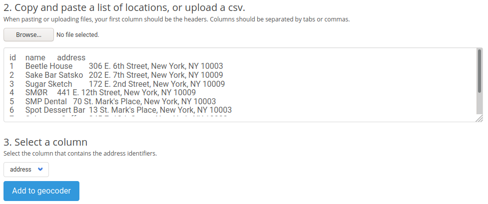
Either copy and paste from a spreadsheet (google sheets, airtable, etc) or upload a file with a header row. Then select your address column.

Checking and fixing results

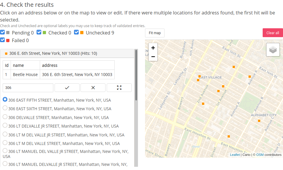
Select an entry, then type into the address box corrections, select the an address from the radio form. Lastly click the check icon to mark the entry checked.

Issues

This tool is currently in Beta and still has some bugs. Below are some known bugs, we are working to fix. Please file a Github Issue if you encounter any others.

  • Spreadsheets may not be formatted correctly when pasted (two column spreadsheets has issues, add an additional column as a temporary go-around)
  • There is an upper limit of ~5,000 rows before the application will crash or start to lag


Import a spreadsheet with New York City addresses and get latitude and longitude information in a heart-beat.

https://www.geocoder.nyc

About Us

BetaNYC is a 501(c)(3) non-profit organization via The Fund for the City of New York’s partner project program.

Our Federal ID / EIN number:
13-2612524.

Solidarity

BetaNYC is a member of the Alliance of Civic Technologists and was an early member of the Code for America Brigade community..


All original content is Copyright, Creative Commons 4.0 Attribution-ShareAlike.

  • LinkedIn
  • YouTube
  • Mastodon
  • Bluesky