BetaNYC is excited to announce the launch of the NYC Urban Heat Portal! Explore it at urbanheat.nyc
What is urban heat, and why does it matter?
New York City, like many urban areas, faces the Urban Heat Island effect, whereby cityscapes become significantly warmer than surrounding rural areas. The growing challenge of extreme heat is a serious public health threat. As noted by the NYC Department of Health, more people die from heat than from all other natural disasters combined in the US. Urban heat risk varies across NYC as a combination of a neighborhood’s landscape characteristics and residents’ access to heat-mitigating resources.
The NYC Urban Heat Portal lowers the technical barrier to accessing data on urban heat in New York City. Developed through a collaborative effort led by Dr. Mehdi Heris and BetaNYC, with crucial support from NASA and key city partners, the portal aims to empower New Yorkers with the data and insights needed to understand the complex science of urban heat and address its critical challenges.
The NYC Urban Heat Portal provides tools to investigate aspects of the urban environment that contribute to disparities in exposure to urban heat. Upon visiting urbanheat.nyc, you are greeted with an interactive map that allows you to immediately explore heat data across the five boroughs

Explore the Science: What You’ll Find on the Portal
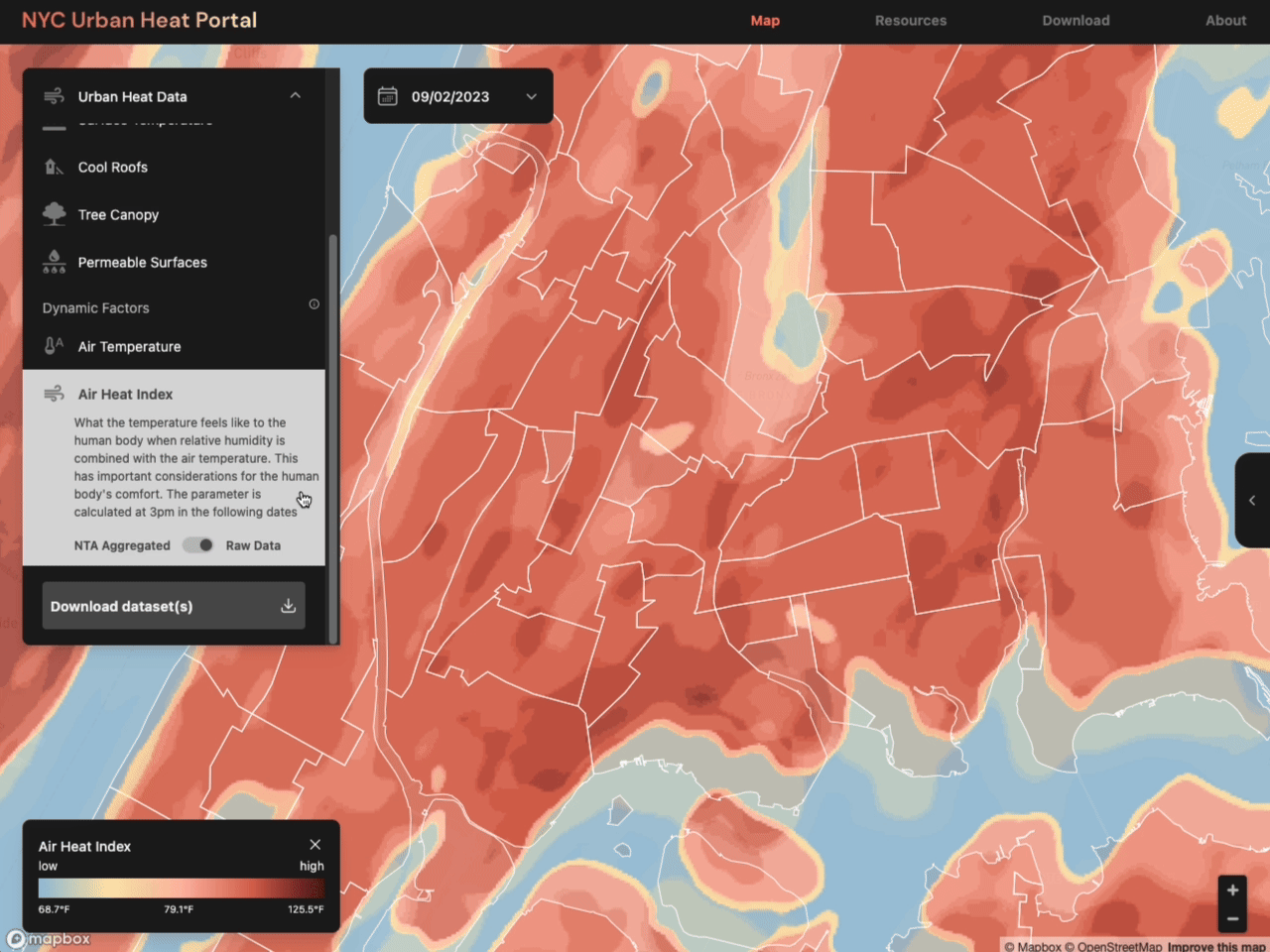
The NYC Urban Heat Portal draws on a variety of data sources, including satellite imagery from Landsat 8 and 9, weather station data, and data produced by Dr. Heris’ team.
Users can:
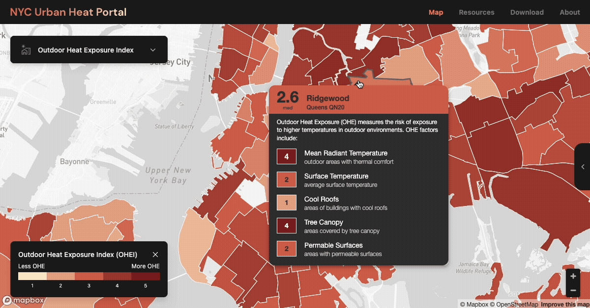
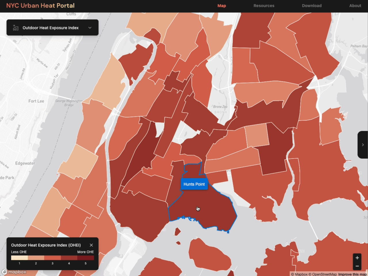
Investigate Key Heat Metrics: The interface allows you to easily visualize and switch between different data layers, such as the new Outdoor Heat Exposure Index, Air Temperature, Mean Radiant Temperature, and Surface Temperature. The portal allows you to explore how these metrics vary across the city. When a data layer is active, hovering over a neighborhood displays a popup that contextualizes the value for that neighborhood with respect to the entire city. The default data layer is the Outdoor Heat Exposure Index, which was developed specifically for this portal by Dr. Heris’ team. The Outdoor Heat Exposure Index measures overall heat intensity in outdoor urban areas by combining the air heat index and mean radiant temperature.
Discover Heat Mitigation Strategies: Learn about and visualize the impact of critical cooling elements like the urban tree canopy, cool roofs, and permeable surfaces.
Analyze Data at Different Scales: View most data layers in their raw format or aggregated by Neighborhood Tabulation Area (NTA). This neighborhood-level view is crucial for understanding and addressing local urban heat-related disparities.
Access Neighborhood Profiles: For a deeper dive into specific areas, the portal offers Neighborhood Profiles. These pages summarize the Outdoor Heat Exposure Index and other relevant data for a selected neighborhood, complete with charts and explanations.
Find Vital Resources: Beyond the maps, the portal connects you with NYC’s official extreme heat resources, including information on cooling centers and the city’s Heat Vulnerability Index. It also features a directory of local urban heat advocacy groups working on the front lines to address these challenges.
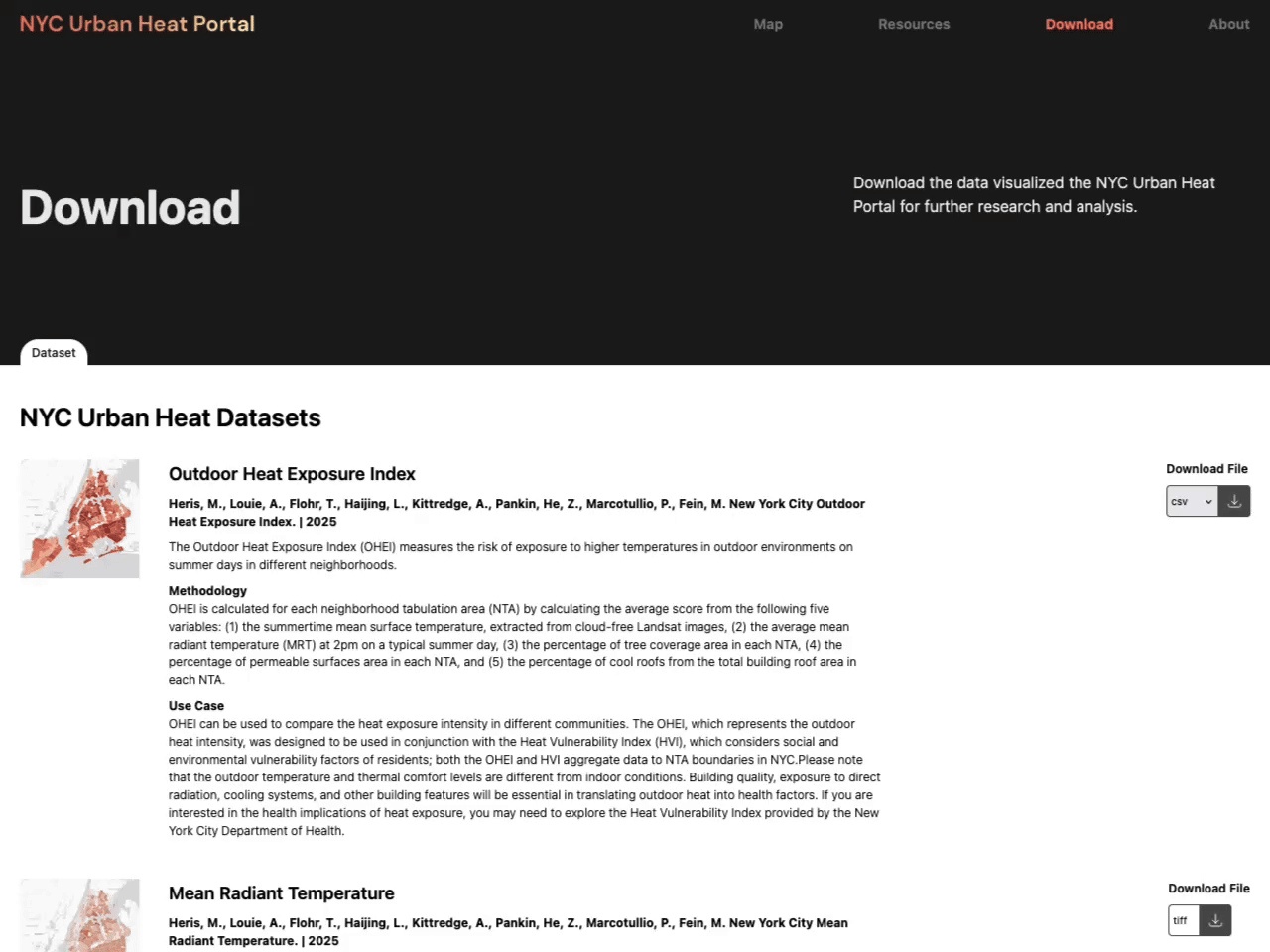
Download Data for Further Analysis: For those looking to conduct their own research or analysis, the portal provides access to a comprehensive collection of NYC Urban Heat Datasets. These include the Outdoor Heat Exposure Index, air temperature, surface temperature, tree canopy data, and more, available in multiple formats.
A Collaborative Effort for a Cooler, More Equitable City
The NYC Urban Heat Portal was a collaborative effort. The Civic Innovation Lab at BetaNYC produced the Portal’s design and was responsible for data visualization and web development. Dr. Heris’ team provided subject matter expertise on urban heat and was responsible for the Portal’s data layers and for conducting interviews with community-based organizational partners, which contributed feedback that was integrated into the Portal’s features and development. The Portal was partially funded by NASA’s Applied Sciences program.
This project empowers efforts to build a more resilient and equitable New York by combining the science of urban heat and data visualization to provide a clearer, more actionable understanding of urban heat dynamics. Use the Portal to understand heat exposure in your community, to inform advocacy and policy efforts, and to support research for a cooler future.
Explore the Portal and Get Involved!
We invite you to visit the NYC Urban Heat Portal at urbanheat.nyc today.